-
×
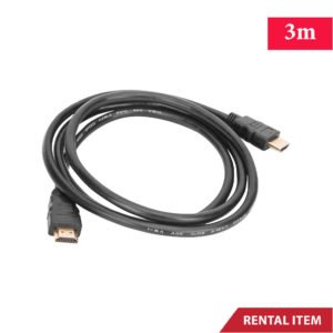 1.4v HDMI Cable 3 Meter FHD
1 × Rs.1,000.00
1.4v HDMI Cable 3 Meter FHD
1 × Rs.1,000.00
Subtotal: Rs.1,000.00


Available for Rent
✅ Survey-grade RTK accuracy
✅ Multi-GNSS positioning support
✅ Compatible with DJI enterprise drones
✅ Fast and easy field setup
✅ Reliable for large survey areas
✅ Cost-effective professional rental solution
Rs.15,000.00 day
Available for Rent
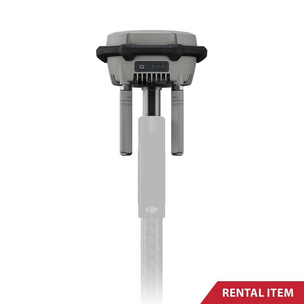
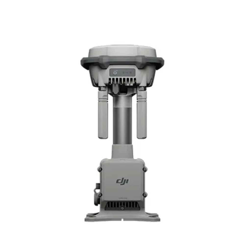
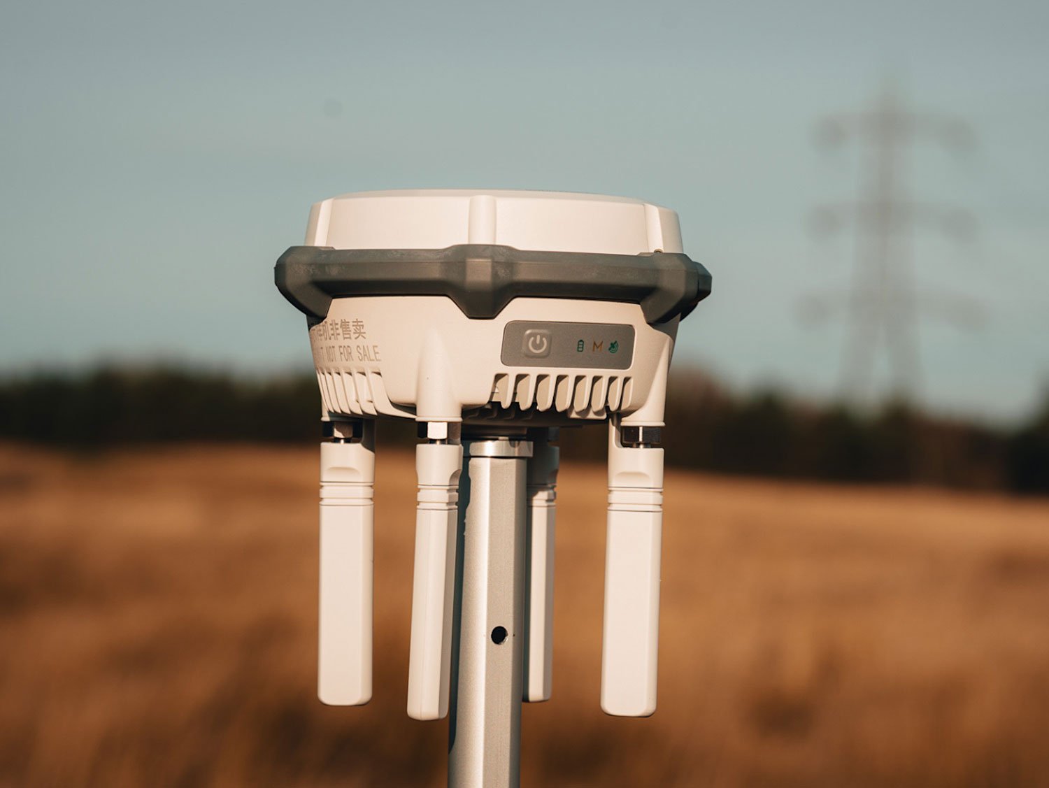
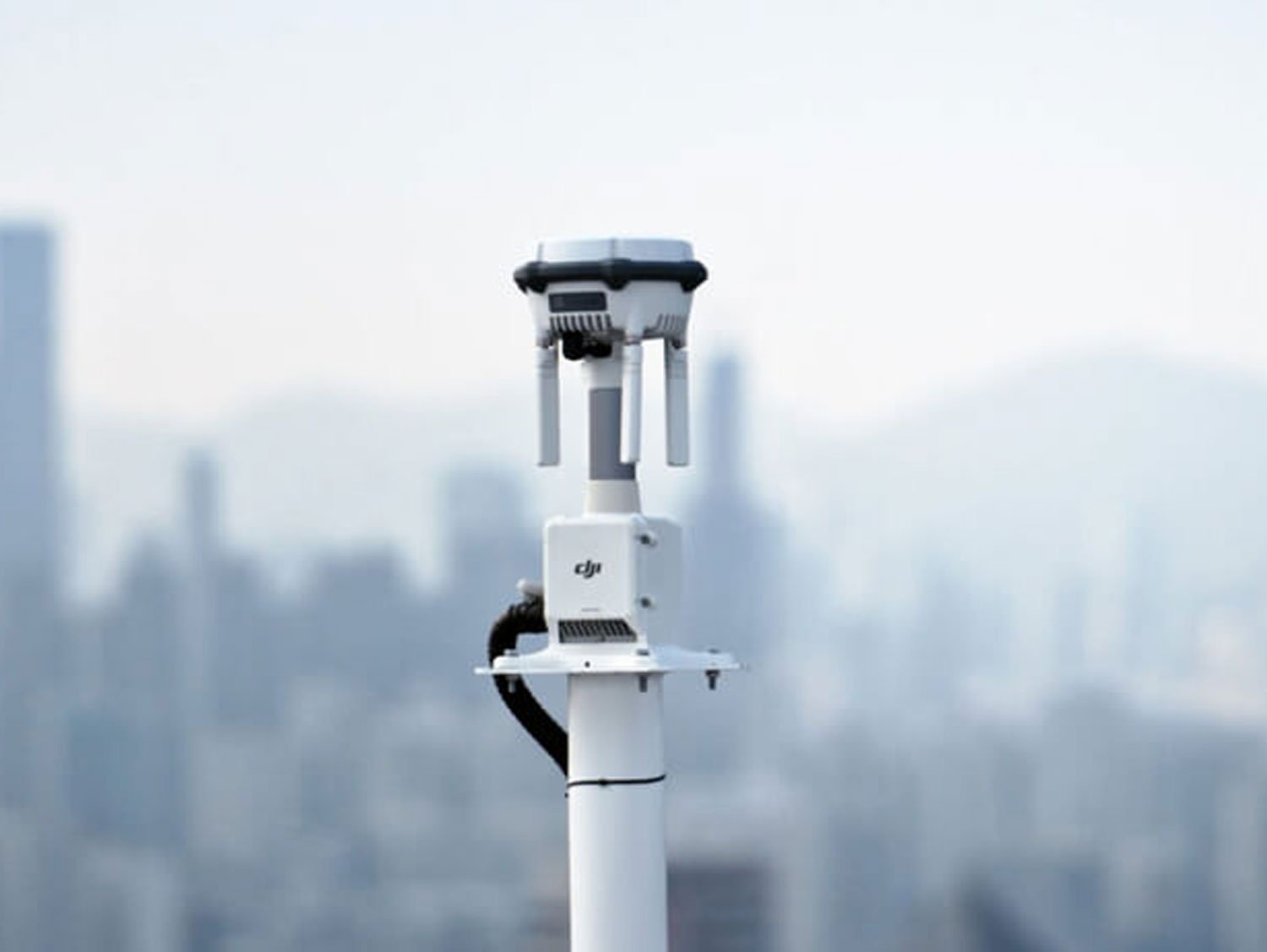
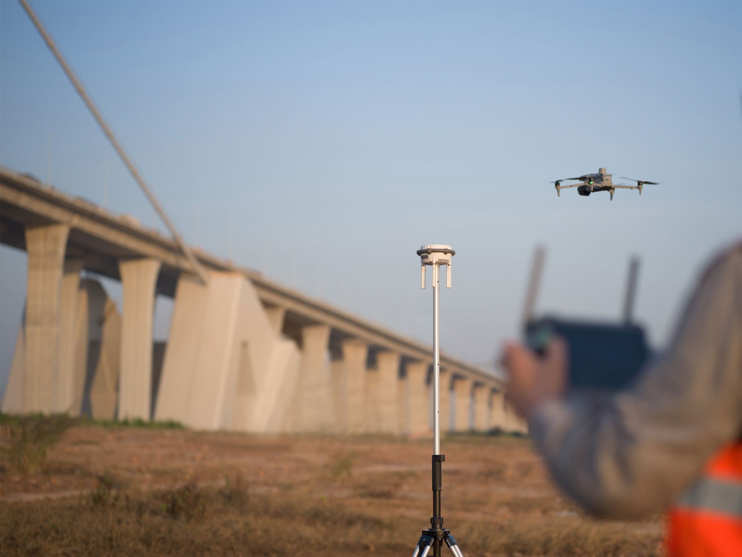
The DJI RTK 3 Multifunctional Station is a professional-grade positioning solution designed to deliver centimeter-level accuracy for drone operations. This advanced RTK base station is widely used with DJI enterprise drones for land surveying, mapping, construction monitoring, agriculture analysis, and infrastructure inspections. When accuracy, reliability, and repeatable data are critical, this is an essential tool for professionals.
The DJI RTK 3 Multifunctional Station works by providing real-time correction data to compatible DJI drones, significantly improving positioning accuracy compared to standard GNSS systems. This ensures that aerial data such as orthomosaic maps, 3D models, and measurement outputs are highly precise and consistent. For surveyors, engineers, and technical teams in Sri Lanka, this reduces rework, saves time on post-processing, and increases overall project efficiency.
At Rentitem.lk, we offer the DJI RTK 3 rental service for professionals who need high-accuracy positioning without the high upfront investment of purchasing the equipment. Our rental units are well-maintained, tested before dispatch, and ready for field deployment. Whether you are conducting a short-term land survey, a multi-day construction project, or a long-term mapping assignment, renting this provides flexibility and cost control while maintaining professional standards.
The DJI RTK 3 Multifunctional Station is designed for demanding field conditions and professional workflows. Its features are focused on accuracy, stability, and ease of use.
Centimeter-level positioning accuracy for professional drone mapping and surveying
Multi-constellation GNSS support for stable and reliable signal reception
Supports base station mode, rover station mode, and relay station mode
Fast setup and easy integration with DJI enterprise drones
Strong signal transmission for large survey areas
Rugged design suitable for outdoor field operations
These features translate directly into practical benefits for users. High-precision positioning allows survey-grade outputs without extensive ground control points. Multi-constellation GNSS ensures consistent performance even in challenging environments such as urban areas or partially obstructed locations. The flexible operating modes make the DJI RTK 3 suitable for a wide range of professional applications, from fixed-base surveys to mobile reference setups.
For teams working under tight deadlines, this reduces flight repetition and minimizes data inconsistencies. This leads to faster project completion, lower operational costs, and improved client satisfaction.
In Sri Lanka, the DJI RTK 3 Multifunctional Station is commonly used across multiple industries that require accurate geospatial data. Land surveyors use it for boundary mapping, topographic surveys, and land development projects. Construction companies rely on it for site planning, progress tracking, and volumetric measurements. Agricultural professionals use RTK-enabled drones for precision farming, crop analysis, and irrigation planning.
Infrastructure development projects such as highways, bridges, and utility installations also benefit from RTK-level accuracy. The DJI RTK 3 helps ensure that measurements align with engineering plans and regulatory requirements. In coastal and environmental studies, accurate positioning is essential for monitoring erosion, vegetation changes, and conservation zones.
Users should be aware that drone operations in Sri Lanka must comply with Civil Aviation Authority regulations. Necessary permissions may be required depending on location, altitude, and purpose of the flight. The DJI RTK 3 itself does not remove regulatory obligations but enhances data accuracy when operations are legally approved.
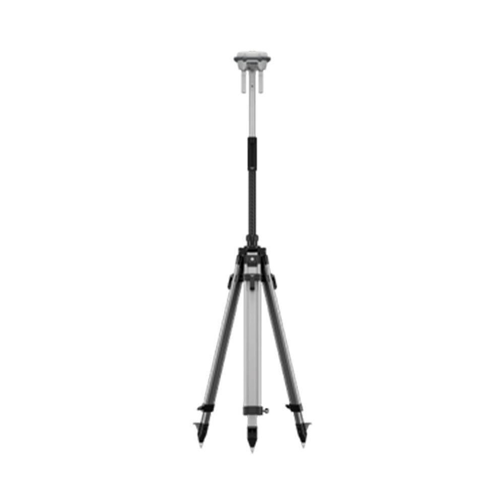
01 x DJI RTK 3 Multifunctional Station
01 x Tripod Stand
01 x Power Adapter
01 x Charging Cable
01 x Carrying Case
It provides high-precision positioning data for DJI enterprise drones used in mapping and surveying.
It is compatible with selected DJI enterprise and RTK-supported drone models.
Basic knowledge of drone mapping and RTK systems is recommended for best results.
Yes, technical guidance can be arranged upon request.
Yes, one-day, weekly, and monthly rental options are available.
The unit is designed for outdoor use, but heavy rain exposure should be avoided.
It can operate without internet in base station mode.
Basic setup and configuration are required before flight operations.
Yes, RTK significantly reduces the need for multiple ground control points.
Delivery and pickup can be arranged separately if required.
| Brands | DJI |
|---|---|
| Model | D-RTK 3 Multifunctional Station |
| Positioning Accuracy | Centimeter-level (RTK) |
| Operating Modes | Base Station, Rover Station, Relay Station |
| Communication | OcuSync / Data Transmission Link |
| Signal Range | Long-range, suitable for large survey sites |
| Power Supply | Built-in rechargeable battery |

✅ High-capacity agricultural spraying
✅ Advanced obstacle detection system
✅ Precision farming technology
✅ Suitable for large farms
✅ Reduces labor and costs
✅ Professional-grade drone performance
✅ Industrial-grade drone platform
✅ High-precision RTK positioning
✅ Supports professional payloads
✅ Long-endurance flight capability
✅ Advanced obstacle sensing system
✅ Ideal for large-scale operations
✅ High-precision industrial mapping
✅ Stable enterprise-grade flight
✅ Professional surveying solution
✅ Reliable long-duration operations
✅ Supports complex inspections
✅ Ideal for Sri Lanka projects


There are no reviews yet.