-
×
 LED Floodlight 50W
1 × Rs.500.00
LED Floodlight 50W
1 × Rs.500.00
Subtotal: Rs.500.00

Available for Rent
✅ High accuracy LiDAR mapping
✅ Professional survey-grade sensor
✅ Strong vegetation penetration
✅ Fast data capture workflow
✅ Enterprise DJI integration
✅ Ideal for complex terrains
Rs.150,000.00 day
Available for Rent
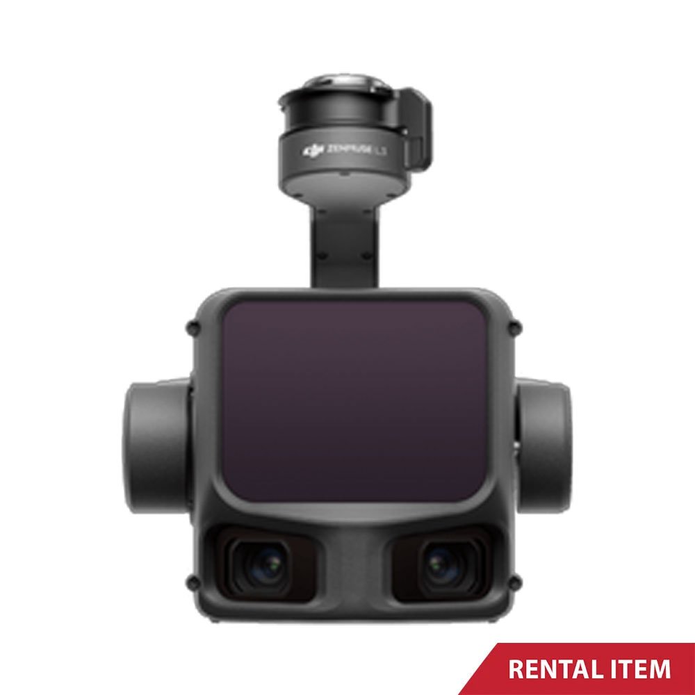
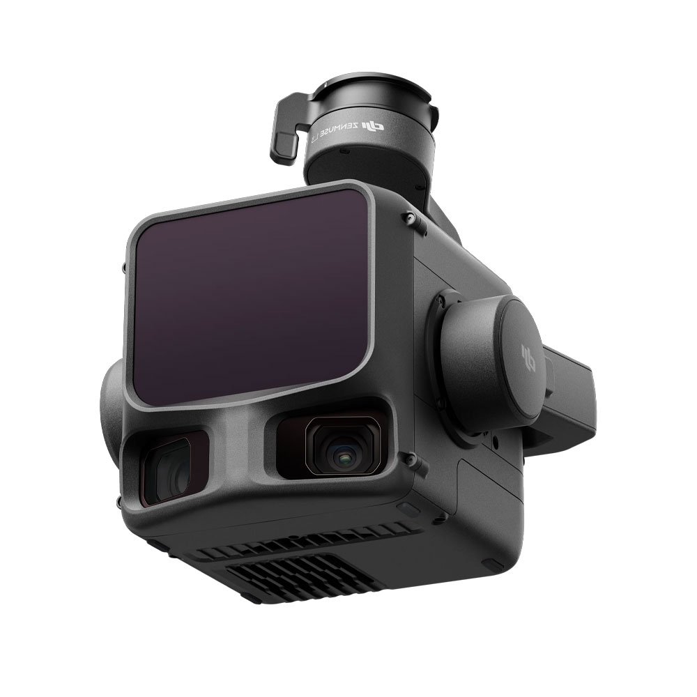
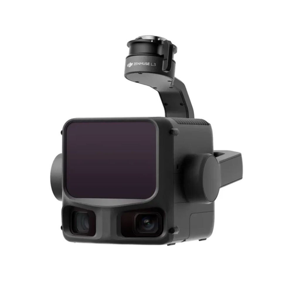
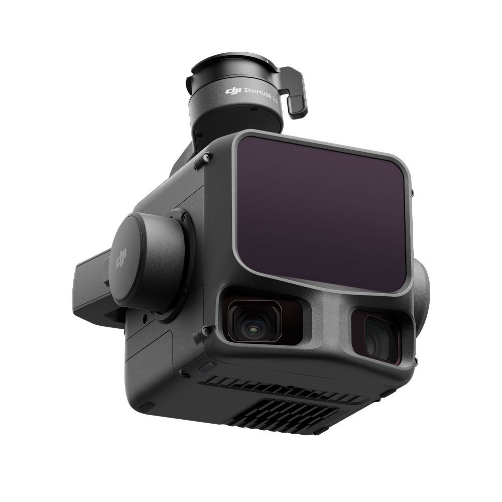
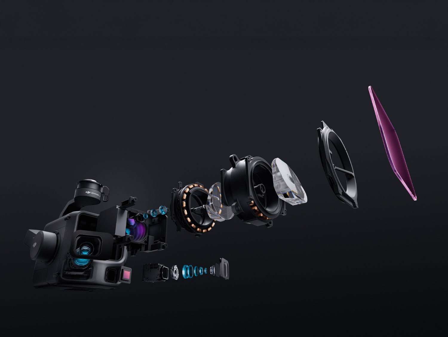
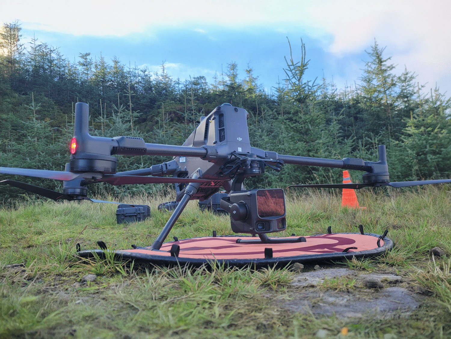
The Zenmuse L3 LiDAR Sensor is a professional-grade aerial LiDAR solution designed for high-accuracy mapping, surveying, and inspection tasks. Built by DJI, the Zenmuse L3 is engineered to deliver reliable geospatial data even in challenging environments where traditional surveying methods are slow, risky, or impractical. When you choose Zenmuse L3 rental from rentitem.lk, you gain access to advanced LiDAR technology without the high capital investment required to own such specialized equipment.
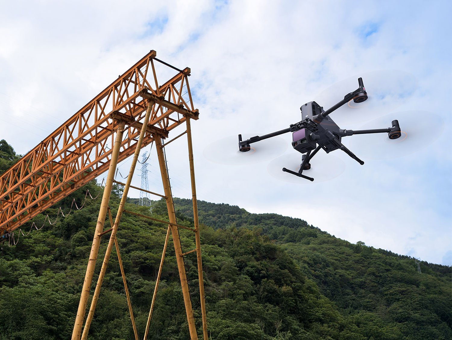
Zenmuse L3 is designed to work seamlessly with enterprise-level DJI drone platforms, making it an ideal choice for surveyors, engineers, construction planners, and infrastructure inspectors. The sensor captures highly detailed 3D point cloud data by emitting laser pulses and measuring their return time. This allows accurate terrain modeling, vegetation penetration, and structural analysis with exceptional precision. In Sri Lanka, where landscapes vary from dense urban zones to forests, plantations, and coastal regions, Zenmuse L3 LiDAR provides consistent results across diverse conditions.
One of the key strengths of Zenmuse L3 LiDAR is its integration with DJI’s ecosystem. The sensor combines LiDAR scanning, high-resolution RGB imaging, and advanced IMU and GNSS data processing to deliver reliable outputs suitable for professional workflows. Whether you are planning a highway project, monitoring land changes, mapping plantations, or inspecting power lines, Zenmuse L3 helps reduce on-site manpower, minimize safety risks, and speed up data collection.
Renting the Zenmuse L3 through rentitem.lk is a practical and cost-effective option for short-term projects, pilot studies, and seasonal survey requirements. Our rental service ensures the equipment is fully tested, calibrated, and ready for professional use. Technical support and operator assistance can also be arranged if required, making it easier for teams to focus on project delivery rather than equipment handling.
The Zenmuse L3 LiDAR Sensor offers a powerful set of features designed to meet the needs of professional aerial data collection. Each feature is carefully engineered to provide accuracy, efficiency, and operational reliability.
High-precision LiDAR scanning
Zenmuse L3 delivers dense and accurate point cloud data suitable for detailed topographic mapping, volumetric calculations, and structural analysis. This level of precision reduces the need for repeated flights and ground verification.
Multi-sensor integration
The system combines LiDAR data with RGB imaging, allowing users to generate realistic 3D models and orthophotos. This integration improves interpretation and decision-making for engineering and planning teams.
Strong vegetation penetration
Unlike standard photogrammetry, Zenmuse L3 can penetrate vegetation to capture true ground elevation. This is especially beneficial for forestry, plantation surveys, and land development projects in Sri Lanka.
Reliable performance in complex environments
The sensor performs consistently in low-light conditions, uneven terrain, and areas with limited visual features. This makes it suitable for early-morning flights, cloudy weather, and complex landscapes.
Efficient data processing workflow
Zenmuse L3 LiDAR is optimized for DJI data processing software, reducing post-processing time and improving productivity. Faster turnaround helps meet tight project deadlines.
Enterprise-grade build quality
Designed for professional use, the sensor is robust and stable, ensuring reliable operation during repeated flights and extended survey missions.
In Sri Lanka, Zenmuse L3 LiDAR Sensor rental is highly valuable across multiple industries. Surveying companies use it for land boundary mapping, contour generation, and elevation modeling for residential and commercial developments. Construction firms rely on LiDAR data for cut-and-fill calculations, progress monitoring, and site planning, reducing errors and rework.
Agriculture and plantation management benefit from Zenmuse L3 by mapping terrain, analyzing drainage patterns, and planning irrigation systems. Forestry departments and environmental researchers use LiDAR data to study canopy density, biomass estimation, and land-use changes without disturbing sensitive ecosystems.
Infrastructure inspection is another key application. Power lines, highways, bridges, and rail corridors can be surveyed safely without sending personnel into hazardous locations. This improves safety while maintaining accurate inspection records.
Users should be aware that drone-based Zenmuse L3 LiDAR operations in Sri Lanka are subject to local aviation regulations. Necessary permissions from relevant authorities may be required before conducting flights, especially in restricted or urban areas. Rentitem.lk can guide clients on best practices and operational considerations to ensure compliance and smooth project execution.
01 x Zenmuse L3 LiDAR Sensor
01 x Protective Carrying Case
01 x Mounting Interface
01 x Connection Cables Set
Zenmuse L3 is used for professional aerial LiDAR mapping, surveying, inspection, and accurate 3D terrain data collection.
It is ideal for surveyors, engineers, construction companies, environmental researchers, and infrastructure inspection professionals.
Zenmuse L3 is professional equipment; beginner users should rent it with an experienced operator or technical assistance.
Yes, compatible DJI enterprise drones and operator-assisted rental options are available upon request.
Operator support is optional and can be arranged depending on project complexity and customer requirements.
It produces high-density LiDAR point cloud data suitable for mapping, modeling, volume calculation, and analysis.
Yes, it performs well in dense vegetation and can capture ground elevation beneath tree canopies.
Yes, necessary approvals from aviation and local authorities are required before conducting LiDAR drone operations.
Data processing software is not included by default and depends on project scope and client requirements.
Zenmuse L3 is available for daily, weekly, and monthly rental periods based on project duration.
| Brands | DJI |
|---|---|
| Model | Zenmuse L3 |
| Sensor Type | Frame-based LiDAR |
| Detection Range | Up to 450 m @ 50% reflectivity |
| Point Cloud Rate | Up to 240,000 points per second |
| Vertical Accuracy | ±5 cm |
| Horizontal Accuracy | ±10 cm |
| Laser Wavelength | 905 nm |
| RGB Camera | 20 MP integrated camera |
| IP Rating | IP54 dust and water resistance |
| Compatible Drones | DJI Matrice 350 RTK |
| Application | Surveying, mapping, inspection |
Zenmuse L3 is available only for professional and commercial use and is not rented for recreational or personal flying purposes.
The item cannot be rented without a compatible DJI enterprise drone. Drone platform availability must be confirmed before booking.
Operator-assisted rental is strongly recommended. Self-operation is allowed only for users with proven LiDAR and drone experience.
All required CAASL and local authority approvals must be obtained by the renter before operating the equipment in Sri Lanka.
The renter is fully responsible for any damage, loss, or misuse of the sensor during the rental period.
Zenmuse L3 must not be operated in restricted zones, no-fly areas, or sensitive locations without written permission.
Use in heavy rain, extreme wind, or unsafe weather conditions is strictly prohibited.
Firmware updates, calibrations, or configuration changes are not allowed without prior approval from rentitem.lk.
The item cannot be sub-rented, transferred, or shared with third parties under any circumstances.
A security deposit is mandatory, calculated according to the selected rental period and company rental policy.

✅ High-capacity agricultural spraying
✅ Advanced obstacle detection system
✅ Precision farming technology
✅ Suitable for large farms
✅ Reduces labor and costs
✅ Professional-grade drone performance

Include: Power Extension Cord

Includes: Power Extension Cord only


There are no reviews yet.