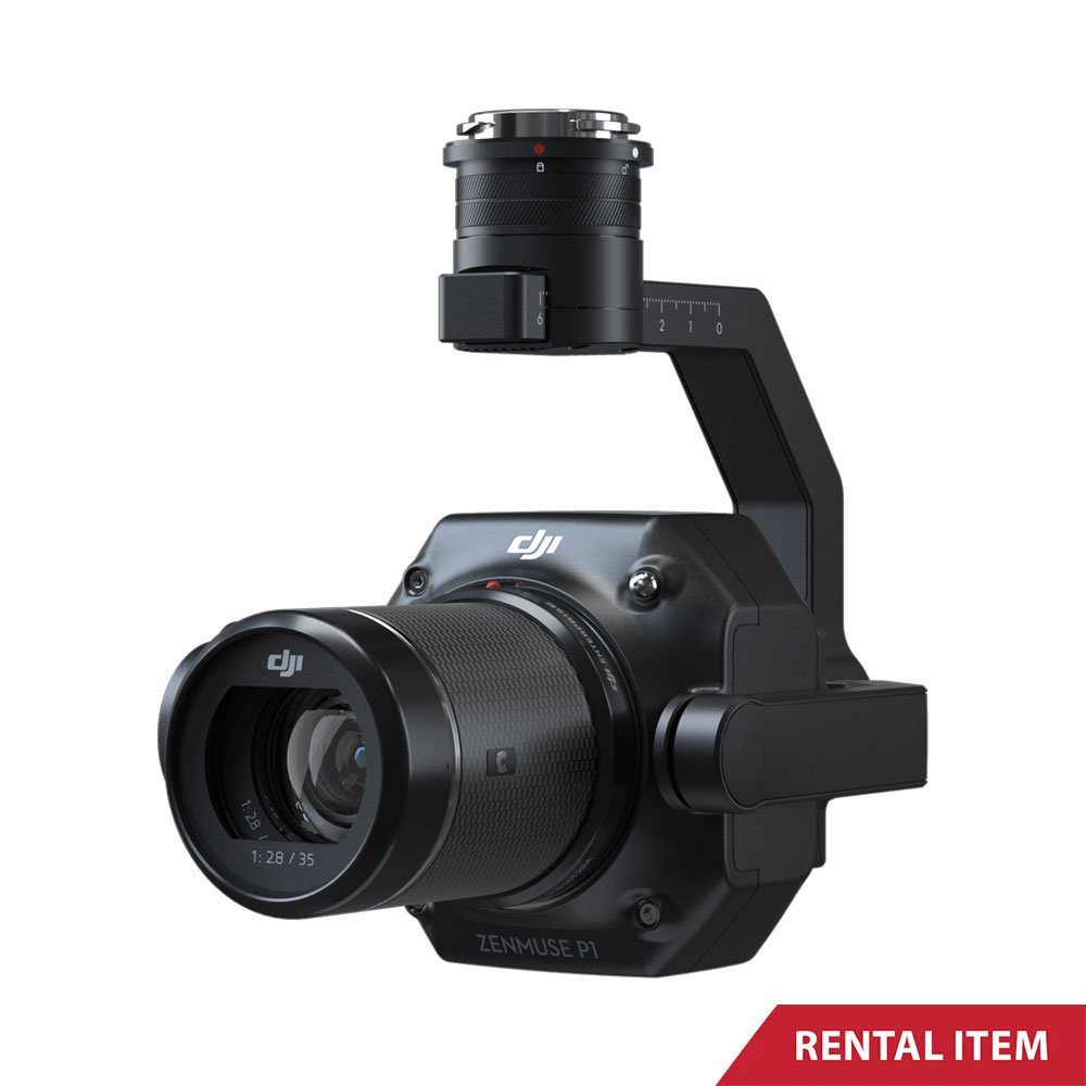
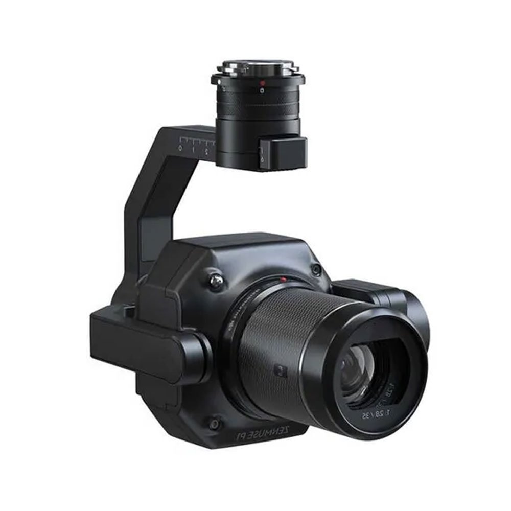
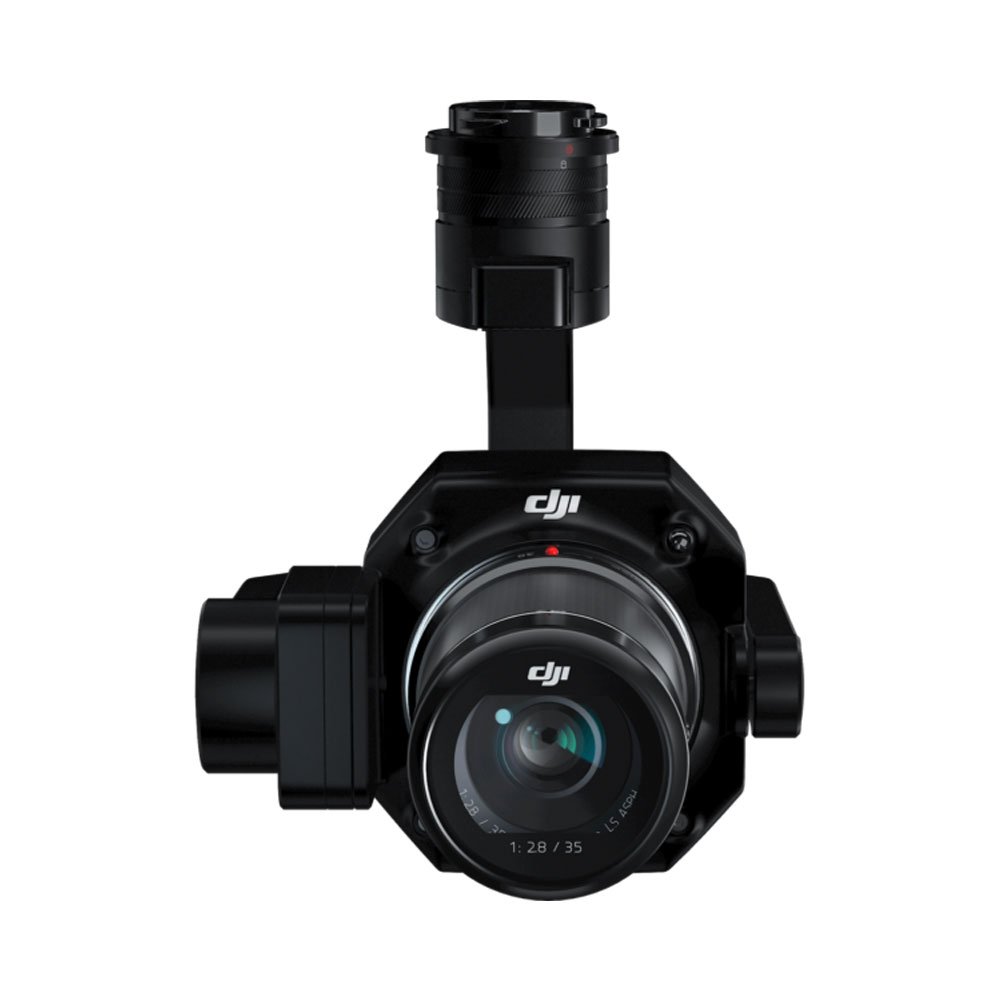
Zenmuse P1

Available for Rent
✅ Full-frame 45MP sensor
✅ Global mechanical shutter
✅ High-accuracy aerial mapping
✅ Interchangeable prime lenses
✅ Professional surveying payload
✅ Enterprise-grade build quality
Rs.40,000.00 day
Available for Rent
Zenmuse P1 Full-Frame Aerial Mapping Camera Rental in Sri Lanka
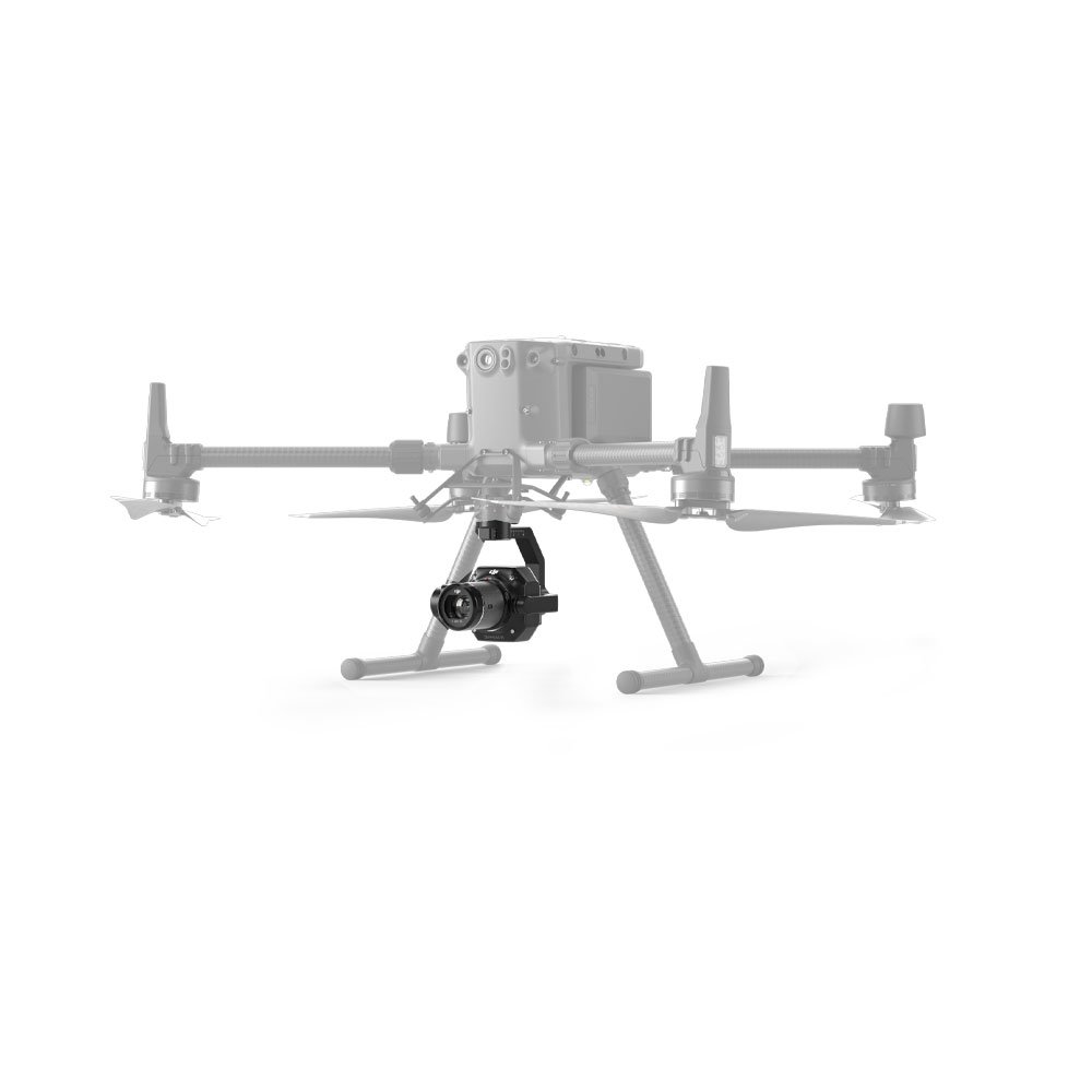
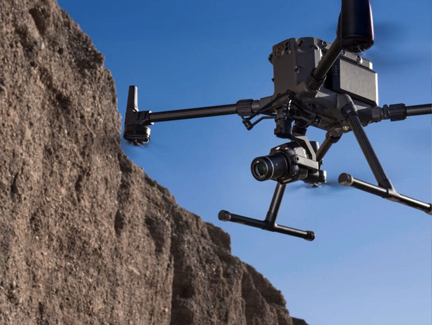
The Zenmuse P1 is a professional full-frame aerial photogrammetry camera designed for high-accuracy mapping, surveying, and inspection work. When you rent the Zenmuse P1 in Sri Lanka from rentitem.lk, you gain access to a powerful aerial imaging solution trusted by surveyors, engineers, and enterprise drone operators worldwide. This advanced camera is purpose-built for precision data capture and integrates seamlessly with professional drone platforms used for large-scale and mission-critical projects.
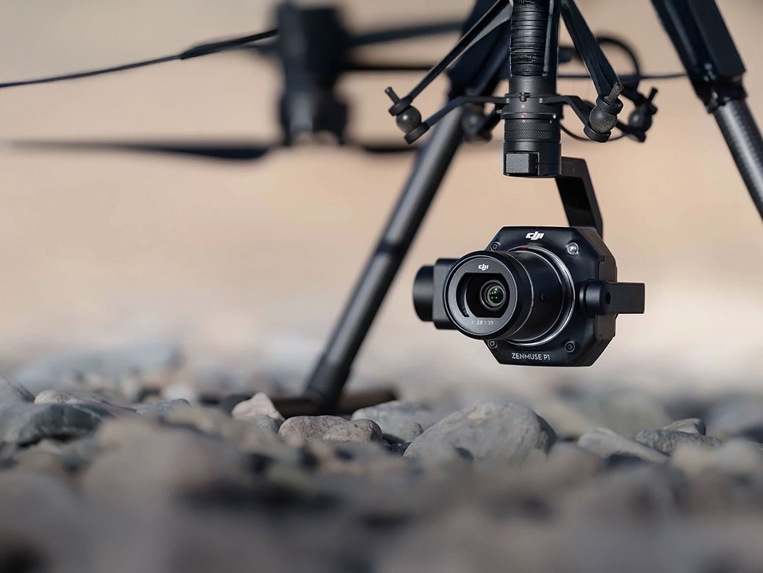
At the core of the Zenmuse P1 is a 45-megapixel full-frame sensor that delivers exceptional image clarity, sharpness, and color accuracy. This allows users to capture highly detailed aerial images suitable for orthomosaic mapping, 3D modeling, and topographic surveys. The camera supports interchangeable prime lenses, giving operators flexibility to choose the right focal length for different altitudes and project requirements. With its global mechanical shutter, this minimizes motion blur and distortion, even during high-speed flight operations.
The Zenmuse P1 is widely used for land surveying, construction monitoring, infrastructure inspection, and urban planning. In Sri Lanka, where development projects range from highways and ports to smart cities and agricultural estates, this camera provides reliable and accurate aerial data. Renting the Zenmuse is a cost-effective way to access enterprise-grade mapping technology without the high investment of ownership. Rentitem.lk ensures that each unit is professionally maintained, tested, and ready for deployment on demanding field operations.
Key Features and Benefits of Zenmuse P1
The Zenmuse P1 offers a range of advanced features that directly benefit professionals working in aerial data capture and mapping applications.
-
45 Megapixel Full-Frame Sensor
The high-resolution sensor captures extremely detailed images, allowing precise measurements and accurate map generation. This reduces the need for repeat flights and improves overall project efficiency. -
Global Mechanical Shutter
The mechanical shutter eliminates rolling shutter distortion, ensuring consistent image geometry even when flying at higher speeds. This is critical for professional surveying and photogrammetry tasks. -
Interchangeable Prime Lenses
Support for different focal length lenses allows users to adapt the camera to various flight altitudes and ground sampling distance requirements, improving flexibility across different projects. -
Smart Oblique Capture
The Zenmuse P1 can intelligently capture oblique images, improving data completeness for 3D reconstruction and complex structural analysis. -
High Efficiency Mapping
With optimized shooting intervals and fast data capture, large areas can be mapped in fewer flights, saving time and operational costs. -
Enterprise-Grade Build Quality
Designed for professional use, the camera performs reliably in challenging environmental conditions, making it suitable for long field days and remote locations.
Practical Uses of Zenmuse P1 in Sri Lanka
In Sri Lanka, the Zenmuse P1 is especially valuable for land surveying and cadastral mapping projects. Surveyors can use it to generate accurate orthomosaic maps and elevation models for land registration, boundary verification, and development planning. The high image accuracy supports compliance with professional surveying standards and reduces manual ground work.
The construction and infrastructure sectors also benefit greatly from the Zenmuse P1. For road construction, expressway development, and large-scale building projects, the camera helps monitor progress, calculate volumes, and identify potential issues early. Engineers and project managers can rely on aerial data to make informed decisions and maintain project timelines.
In agriculture and plantation management, the Zenmuse P1 supports large-area mapping for crop planning, irrigation design, and land optimization. Tea estates, paddy fields, and coconut plantations can be surveyed efficiently, even in hilly or hard-to-access areas. For environmental studies and disaster management, the camera is useful in monitoring landslides, flood-prone zones, and coastal changes.
Operators in Sri Lanka must follow Civil Aviation Authority regulations for drone operations, including necessary approvals for commercial flights. Rentitem.lk can guide renters on operational best practices and recommended setups to ensure safe and compliant usage.
Includes with Zenmuse P1 Rental
01 x Zenmuse P1 Camera Unit
01 x Compatible Mount System
01 x Protective Carrying Case

 Frequently Asked Questions
1. Is the Zenmuse P1 suitable for professional land surveying?
Yes, it delivers high-accuracy photogrammetry data suitable for professional land surveying, mapping, and engineering-grade measurement applications.
2. Can I rent the Zenmuse P1 without a drone platform?
No, the Zenmuse P1 must be mounted on a compatible professional drone platform to operate correctly and safely.
3. Does Rentitem.lk provide technical support for setup and use?
Yes, technical guidance and optional professional operator support can be arranged upon request for safe and efficient operation.
4. Is prior drone flying experience required to use Zenmuse P1?
Yes, professional drone piloting experience is strongly recommended due to the advanced nature and value of the equipment.
5. Can Zenmuse P1 be used for construction progress monitoring?
Yes, it is ideal for construction progress tracking, volume calculations, site inspections, and detailed aerial documentation.
6. Are camera lenses included with the Zenmuse P1 rental?
Lens availability depends on stock and project requirements; please confirm lens options with Rentitem.lk before booking.
7. Is Zenmuse P1 suitable for agricultural and plantation mapping?
Yes, it supports large-area agricultural surveys, plantation mapping, land analysis, and terrain modeling efficiently.
8. Does the Zenmuse P1 support RAW image capture?
Yes, it captures both RAW and JPEG images, allowing maximum flexibility for post-processing and data accuracy.
9. Are legal approvals required to operate this camera in Sri Lanka?
Yes, commercial drone operations require approval from relevant Sri Lankan aviation and regulatory authorities.
10. What rental periods are available for Zenmuse P1?
Rentitem.lk offers daily, weekly, and monthly rental options based on project duration and operational requirements.
| Brands | DJI |
|---|---|
| Sensor | Full-Frame CMOS |
| Resolution | 45 Megapixels |
| Shutter Type | Mechanical Global Shutter |
| Lens Support | Interchangeable Prime Lenses |
| Image Format | JPEG / RAW |
| Application | Mapping, Surveying, Inspection |
Limitations
-
The Zenmuse P1 is not a standalone camera and must be used with a compatible enterprise drone platform.
-
Operation requires experienced and licensed drone pilots; it is not suitable for beginners or hobby-level users.
-
Commercial drone flights in Sri Lanka require prior approval from relevant aviation and regulatory authorities.
-
The camera is optimized for mapping and surveying, not cinematic video recording or creative filmmaking.
-
Lens options are fixed prime lenses only, limiting zoom flexibility during flight operations.
-
Performance may be affected in heavy rain, strong winds, or poor visibility, common during monsoon seasons.
-
High-resolution image data requires powerful computers and specialized software for processing and analysis.
-
Battery endurance depends on the drone platform, not the camera itself, limiting continuous flight time.
-
Ground control points (GCPs) may still be required for survey-grade accuracy, depending on project standards.
-
Not recommended for indoor or confined-area flights due to operational safety and GPS dependency.
Notes
Based on 0 reviews
Be the first to review “Zenmuse P1”
Related products
-
Aerial Drone, Drone Payload, Drone Payload, Industrial Drone, Industrial Tool
Zenmuse H30
✅ Professional multi-sensor drone payload
✅ High zoom inspection capability
✅ Advanced thermal imaging support
✅ Enterprise-grade reliable performance
✅ Ideal for inspection and surveillance
✅ Flexible short and long rentalsSKU: RISER-054-043 -
Aerial Drone, Drone, Drone, Industrial Drone, Industrial Tool
DJI Agras T50 Agriculture Spraying Drone
 Aerial Drone, Drone, Drone, Industrial Drone, Industrial Tool
DJI Agras T50 Agriculture Spraying Drone
✅ High-capacity agricultural spraying
✅ Advanced obstacle detection system
✅ Precision farming technology
✅ Suitable for large farms
✅ Reduces labor and costs
✅ Professional-grade drone performanceSKU: RISER-054-035


There are no reviews yet.